


geisler

VacheKiri67
User
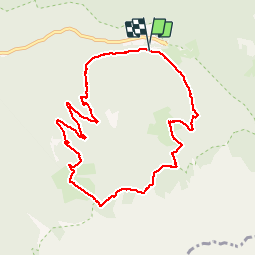

Length
9.5 km

Max alt
2039 m

Uphill gradient
423 m
Km-Effort
15.1 km

Min alt
1662 m

Downhill gradient
423 m
Boucle
Yes
Creation date :
2019-07-30 07:58:37.023
Updated on :
2019-07-30 20:27:34.394
5h09
Difficulty : Medium

FREE GPS app for hiking
 SityTrail
IGN / Geographical institutes
SityTrail Plus
The world is yours!
About
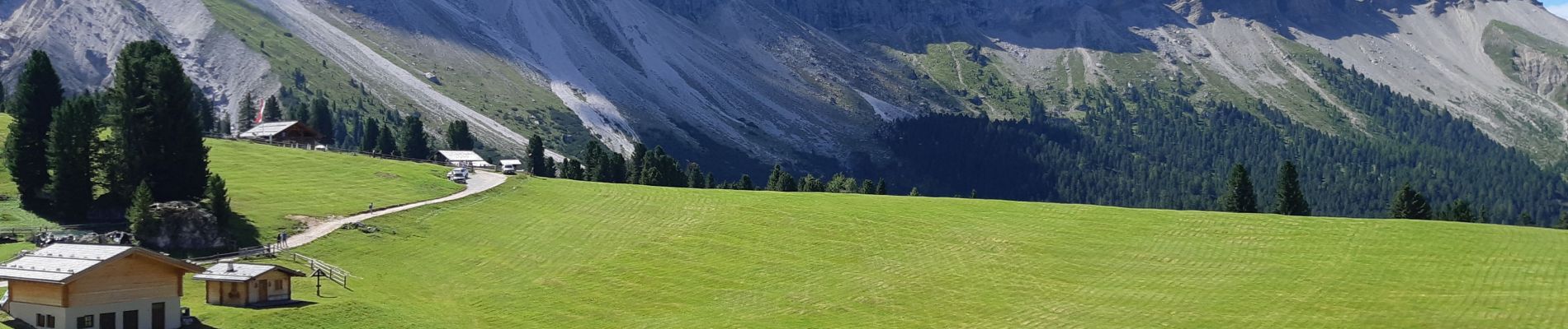
Trail Walking of 9.5 km to be discovered at Trentino-Alto Adige/Südtirol, South Tyrol, Villnöß - Funes. This trail is proposed by VacheKiri67.
Photos


39 photos in total. Please click on a photo to see them all in the gallery.
Positioning
Country:
Italy
Region :
Trentino-Alto Adige/Südtirol
Department/Province :
South Tyrol
Municipality :
Villnöß - Funes
Location:
Unknown
Start:(Dec)
Start:(UTM)
711438 ; 5168322 (32T) N.
Comments